 |
(cont.)
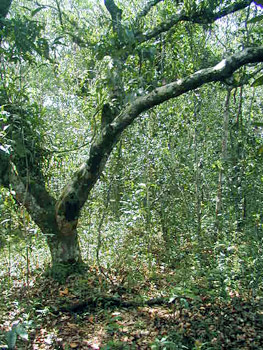
 Castanheira |
 Adult plant in Sumaúma |
 Macucu (Aldina heterophylla) |
ON: How is the distribution of the orchids in the Amazon region, the most part of them occurs in the borders? PI:
They are spread over the Amazon region: they occur in the crown of the
trees, in igapós; in the forest of varzea (flood plains); in
open areas and mountains, in the Brazilian shield as well as in the
Guyana one. |
ON:
The survey you published in the proceeding of the First National Meeting
of Orchidists and Orchidologists can be considered as a summary of the
work you did during your first stay in the state of Amazonas? Was it
your most important work you have done by this time? ON: Do think that Amazon region still has many surprises? PI: Even no described species are found there. It is probably that, in the next journey, I will discover species not registered for Brazil or new for the science. With the dissemination of information about orchids, the number of orchidists increases and, thus, often, new occurrences appear to Brazil. |
ON:
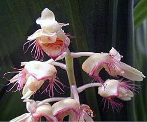
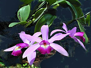
Which is the Cattleya that has more number of specimens?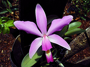 PI:Cattleya violacea. |
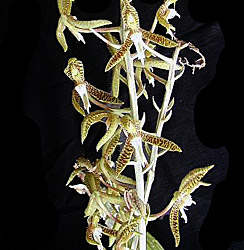
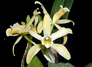
ON: Which would be the main genus in the Amazon region, could it be the Catasetum? PI: I think so. The Amazon region is very rich concerning this genus, there are a lot of species of Catasetum. |
 |
 |
 |
Catasetum
stenoglossum |
Catasetum
discolor |
Catasetum
barbatum |
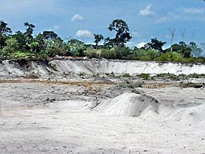
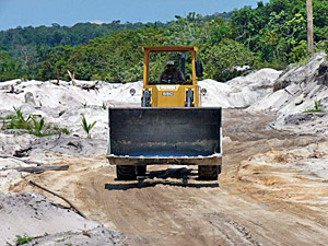
ON: Which species is most threatened of extinction? PI: In the nature, Cattleya eldorado has the biggest vulnerability, on the other hand, it is preserved on cultivation. It occurs in both side of the Negro river, around Manaus, Manacapuru and going until Barcelos. It grows in the campinas (drylands) and in igapó, however, the most big area of occurrence is around Manaus, in campinas. There, the reserves of white sands are being destroyed by the extraction for using in constructions, in kinescope industry and for making fields to the cultivation of pineapple or cashew. Trucks and trucks have been removing the sand, thus, those areas are, slowly, being destroyed. |
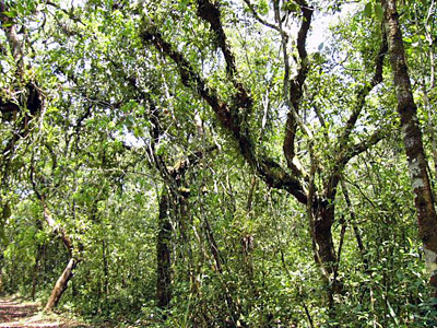 Campina in natural conditions nearby Manaus |
|
 |
 |
Impacted
Campina nearby Manaus due to the removal of sand |
|
| The INPA has a campina relatively preserved which works as a biological reserve however the felling of the forest for cultivation is getting there. The Ibama also has another area which is a big and preserved campina. Fortunately, there are many other campinas in the Brazilian Amazon. |
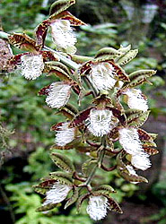
 Orleanesia Amazonian, originally described from the quarter of Ponta Negra, in Manaus City |
Just
for having an idea, Orleanesia amazonica has been originally
described for the municipal district of Manaus, in the quarter
of Ponta Negra. Nowadays the local-type is being destroyed for
the construction of builds and this can't be reversed. This region suffers the pressure for construction although it is part of the Area of Environmental Protection of Negro river (APA). Concerning the campina, I oriented a Dissertation about the Encyclia mapuera (Encyclia tarumana) and its distribution. I also oriented a thesis of Master in "Physiology and Anatomy of the Orchids from Campina”. For the Doctorate, I am orienting two another thesis: One about the “The Distribution of the Cattleya eldorado, in one Hectare of the Campina Forest”, and another about “The Physiology and Anatomy of the Orchids from Campina" where all parameters are being measured (the occurrence, |
| on what point of the trees). |
ON: And about the deforestation, in general? PI:
The state of Amazonas, with the creation of a Free Zone of Manaus which
has a proper industry, generates little impacts and stays, until today
as the most preserved state of the north region. The deforestation is
being done in Rondônia, Pará and most recently in Roraima,
where starts an agricultural front. In the borders of the Amazon occurs
a dry forest and with the clearing, the "effect of edge" (which
changes the parameters of humidity and wind coming from the interior
of the forest) tends to transform the adjacent vegetation in dry forest,
in this way, in the future, the vegetational complexes which occur in
the region can be compromised.
|
||||||||
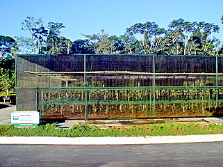
ON: How has being the development of the work you are doing together with Petrobrás? PI: All collected orchids are brought to me for identification. In 1977, I got a financial support from Petrobrás to do a study about the Epiphyte Orchids in Petrol Field of Urucu, in the Municipal District of Coari, in the state of Amazonas. I have been held several consultations for Petrobrás: in Urucu, in the greenhouse; in the Floral Theme of the EPIA/RIMA of the pipeline Coari-Manaus. As the responsible technician for the license to fell for the implantation of the pipeline, I selected adequate areas for being the store of the pipes, with the smallest impact as possible; I coordinated the program of pre-communication of the pipeline concerning the flora theme, by identifying the occurrence of the threatened species of trees and protected from being cut, by IBAMA. During the construction of the pipeline Coari-Manaus, I will coordinate a team to do the rescue of orchids and epiphytes. They will be placed in the greenhouse in Urucu. Additionally, inside the Policy of Sustainable Development, Petrobrás, in a convention with the Federal University of Amazonas (UFAM), through the Center of Environment, (CCA), is developing a wide and multidisciplinary project named PIATAM - Possible Impacts in the Transport of Gas and Petrol - which gathers the channel of the Solimões river, in predetermined stations in the phases of flood or ebb-tide, since Coari until Manaus. This project, which is in the beginning of the fourth phase, is being consolidated in a program of permanent environmental attendance. It aims the production of environmental researches and diagnosis that can help the company to deal with the possible impacts resulted from the transportation of petrol products over the river and in the vicinity. This study started 10 years ago, four excursions for year encircling 60 km of the basin. I have been characterized and produced thematic maps of the vegetation, by the geoprocessing. I am taking, when possible, notes about the place of the occurrence of orchids and every time I can, I collect, herborize and take photos. |
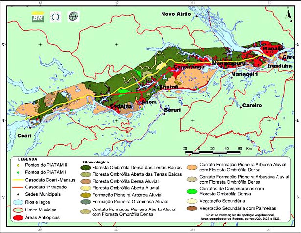 |
Thematic
map of the flora, showing the tracing of the pipeline project Coari-Manaus
one of the points of PIATAM collection |
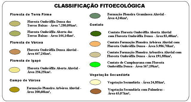 |
Phytoecological
classification of the vegetational typologies which occur in the area
of the tracing of the pipeline Coari-Manaus |
Orchids
which occur along the tracing of the pipeline project of Coari-Manaus |
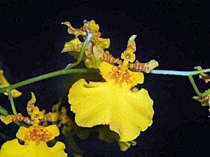 Oncidium cebolleta (Várzea - flood wood) |
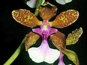 Oncidium lanceanum (dryland) |
 Cattleya luteola (Várzea - Flood forest) |
Cattleya violacea |
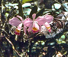
Cattleya eldorado |
Rodriguezia lanceolata |
|
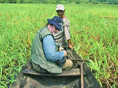
ON: Which are the aims of this project? PI: There are many. In Flora Theme is the mapping and characterization of the vegetational typologies, the identification of the aquatic macrophytes and the riparian plants, the collecting and the identification of the species in different environments, the verification of the status of vegetational preservation, the identification of the phorophytes and their epiphytes, the utilization of the epiphytes as an indicator the status of the habitats preservation, the elaboration of list of species by habitat and their economical importance, the description of the syndromes of the polenization and dispersion of the fruits. ON: You said EPIA-RIMA, what does it mean? ON: For any work which involves environmental impact, a previous study should be done and the report of environmental impact submitted to public hearing in order to obtain the license to do this work. The construction of the pipeline has been already authorized. The license to construct the clearings for storing de pipes is also got. The pipes will be transport by ferry boat during the flood until the clearings near to the pipeline, in places where the boats can arrive. At first, 49 hectares of wood would be cut down. We succeeded in reducing it to 4,5 hectares of virgin forest. We used degraded areas to serve as stores for the pipes ("capoeira" -brush, football field, pasturage, plantation field, etc.). Every thing was negotiated with the communities which be properly indemnified. During and after finishing the works, the impacted areas will be recomposed. The football field will be reconstructed in another place. Recently we finished the program of license to do the deforestation and the first phase of the pre-communication of the construction of the pipeline. Since August, we go to the field, every month in order to get the directrix of the pipeline which is theoretical. We need the GPS to know the exact place of the tracing. To get there, the basic transport is the canoe. When there is no river, we should walk and, sometimes, cross over swamped areas with water until the knees. |
 |
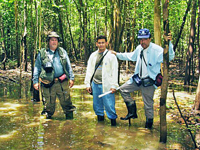 |
| Pedro Ivo with members of UFAM and Petrobrás teams, studying field along the directrix of the project of the pipeline Coari-Manaus | |
ON: Which is the extension of this pipeline? And which is the width it will occupy in the wood? PI: The pipeline is 393,8 km long and 15m width. After finishing the work, there will be only a strip with 5m width covered with law vegetation. The pipes will stay at 2m and half of depth. In the initial project, the course goes through an expressive part of the "varzea" (flood forest) and through a big area of campina (dryland), where occur many orchids. I suggested the modification of the course, which was accepted by the engineers of Petrobrás. So the most part is placed in dryland in order avoid troubles with the fishes. When there is the crossing of water bodies, the directional perforation will be employed. For example, the pipe will be placed under the Solimões river at 28m of depth. This technique is similar to that used for constructing the tunnel of the channel, connecting England to France. With this technology, Petrobrás can perforate until at about 2 km. The technicians usually do it in Campos Basin (State of Rio de Janeiro). In the directional perforation, the drill penetrates in an inclined position then the pipes are placed and concreted. ON:
Only the bad things are divulgated, those good initiatives are not diffused.
Nobody talks about the project of regeneration in the area which will
be affected. However in a project of this magnitude, it is necessary
to predict the micro and macro impacts which will provoke important
modifications in the ecosystem and it consequences, included socio-economical.
|
ON: In what phase is the project now? PI: The deforestation will start soon. Before that, the environmental preventive will happen. Each tree which is on the list of species threatened of extinction can't be cut down, it is all about 6 or 7 species, as showed on the table bellow. The orchids, bromeliads and also another epiphyte plant will be collected for the nursery of Urucu and for the Federal University of Amazonas. Species included in the list of the protected plants by IBAMA which will be preserved in the environmental preventive for the implantation of the pipelines. |
SCIENTIF
NAME |
FAMILY |
ORDINARY
NAME |
ENVIRONMENT |
CATEGORY |
| Aniba rosaeodora Ducke | Lauraceae | Pau-rosa | Dryland | Endangered (E) |
| Bertholletia excelsa Bonpl. | Lecythidaceae | Castanha do Brasil | Dryland | Vulnerable (V); |
| Bowdichia nitida Spruce ex Benth. | Leguminosae | Sucupira-preta | Dryland | Vulnerable (V); |
| Hymenaea courbaril L. | Leguminosae | Jatobá | Dryland | Endangered (E) |
| Pithecellobium racemosum Ducke | Leguminosae | Angelim-rajado | Dryland | Vulnerable (V); |
| Virola surinamensis (Rol. Ex Rottb) Warb. | Myristicaceae | Ucuúba | Várzea (Flood forest) | Vulnerable (V); |
| Vouacapoua pallidior Ducke | Leguminosae | Acapu | Dryland | Endangered (E) |
ON: After de construction, as the pipeline will stay underground, is the possibility of regeneration of the forest quite big? PI: Of course, it is. The impact provoked in forest is small and transitory. The first part from Urucu until Coari is already regenerated, you can't see any more the cut in the forest. As I said, first, 15 meters are cut but when the works finish, there will be just a strip of 5 meters width with law vegetation. In order not to avoid the passage of the animals from one side to another, every 10 km, "green bridges" will be constructed. The roots of the Amazon trees grow in the superficial layers of the ground. No more than 2-3m depth because the soil is rich in aluminum which is toxic for plants. More deep we get, bigger is the concentration of this mineral, that's why the trees in this region don't have pivotal roots. When a tree drops, we can it easily. In the areas of “green bridge”, the ground will be raised and the pipeline will be placed more deeply and concreted. In this way, the risk of roots perforating it can be avoid. To get a license for a project, you should know which species occur, which should be preserved, which can't be cut. We should have the necessary argumentation. |
Photos:
Pedro Ivo Soares Braga
|